Land Surveyors in Singleton
- 100+ years’ combined experience
- Award-winning subdivision projects
- Residential & commercial surveying experts
Request A Call Back in Singleton
Thank you for contacting Duggan Mather Surveyors.
We will get back to you as soon as possible.
Oops, there was an error sending your message.
Please try again later.

Singleton Land Surveyor
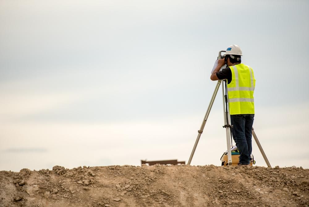
Starting a building or development project in Singleton? Finding the right professional land surveyor is one of the first steps you’ll need. At Duggan Mather Surveyors, we’ve been helping property owners, builders and developers throughout Singleton for decades, offering reliable, accurate surveys backed by over 100 years of combined industry experience.
We specialise in topographic, detail and level surveys that help you understand the shape, boundaries and features of your land—whether it’s a rural block, town lot or multi-dwelling site. Our work supports everything from design and planning to council approvals and construction, and we tailor each survey to suit your needs and site conditions. Singleton clients appreciate our honest advice, fast turnaround and clear communication throughout the process.
We also work directly with your architect or builder to ensure all the right information is passed on. No matter the size or stage of your project, we’ll help you start on the right foot. Call 02 4919 0293 to book your land survey in Singleton or speak with our team today.
Helping You Build with Confidence
Land in Singleton isn’t always straightforward—some blocks are steep, some are semi-rural and others sit within tight residential pockets. That’s why we take the time to understand the site before we even start measuring.
Our team uses up-to-date technology to capture detailed data on boundaries, gradients, structures and easements, delivering plans that make your next steps clear. We know the local council's expectations and tailor each survey to suit your application or build. Everything we provide is practical, well-presented and easy to interpret, so you’re not left trying to make sense of technical language. We also check in regularly, keeping you and your contractors informed every step of the way.
Our goal is to help you avoid setbacks and feel confident in the decisions you’re making. From new homes to subdivisions and everything in between, we’ve got the groundwork covered.
Frequently Asked Questions
What is a contour survey?
A contour survey maps the elevation and slope of a parcel of land by recording its vertical height at various points. This creates a set of contour lines on a plan, showing how the land rises or falls. Builders, architects and engineers use these surveys to understand how terrain affects construction or drainage. Councils may require a contour survey for development applications, especially on sloped or irregular blocks. It helps guide earthworks, retaining wall placement and stormwater design, ensuring buildings work with the landscape rather than against it.
What are site setouts, and why are they important?
Site setouts involve marking where structures or infrastructure will be located on a construction site, based on architectural and engineering drawings. Surveyors use plans to determine exact coordinates and then mark points on the ground for foundations, walls, columns, service trenches and more. Accurate setouts ensure the building is constructed in the right position and meets local setback or zoning requirements. Mistakes at this stage can lead to costly rework or non-compliance, so precision is key. Surveyors also revisit the site to verify completed work or mark additional features.
How accurate are modern land surveys?
Modern surveys can achieve millimetre-level accuracy thanks to advances in GPS, total stations and digital modelling tools. The level of accuracy depends on the purpose of the survey—for example, construction setouts require higher precision than a broad topographic overview. Licensed surveyors follow strict industry standards to ensure measurements meet legal and technical requirements. Accuracy is also influenced by the equipment used, environmental conditions, and reference data such as control marks or title plans. Clients can expect survey reports to be dependable, consistent and highly reliable.
- Newcastle
- Lake Macquarie
- Port Stephens
- Maitland
- Wyong
- Gosford
- Forster
- Cessnock
- Taree


